West Coast America climate
The cool California Current offshore, enhanced by upwelling of cold sub-surface waters, often creates summer fog near the coast, creating a warm-summer Mediterranean climate (Köppen climate classification Csb). Further inland, the climate becomes more continental, with some areas turning semi-arid (Köppen BSk), with colder winters and markedly hotter summers. Low-lying inland valleys, especially the Central Valley, have a hot-summer Mediterranean climate (Köppen Csa), with subtropical temperatures but a well-defined summer dry season and a foggy, rainy season in winter.
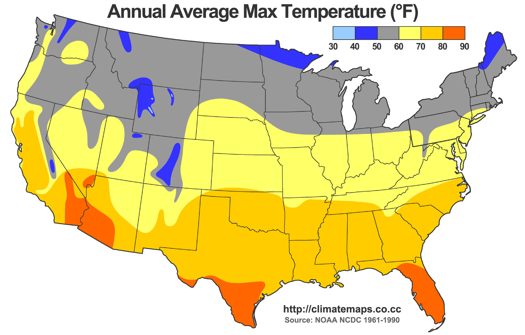
The temperature gradient between immediate coast and low-lying inland valleys in the south is about 7 °F (4 °C) in winter (the coast being warmer) and in summer roughly 25 °F (14 °C) (the interior being warmer). However, during the cooler winter months (October-March) the Coachella Valley regularly has the warmest winter temperatures out of any place west of the Rocky Mountains. East Los Angeles, Gateway cities, and parts of San Gabriel Valley region averages the warmest winter high temps (72 °F) in all of the western U.S., and Santa Monica averages the warmest winter lows (52 °F) in all of the western U.S. Palm Springs, a city in the Coachella Valley, averages high/low/mean temperatures of 75 °F/50 °F/63 °F, (24 °C/10 °C/17 °C) respectively during the period of cooler weather from November to April.[1] The temperature difference is most dramatic nearer the coast. For example, the average daily high in San Francisco in July and August is 72 °F (22 °C), and in Walnut Creek, some 20 miles (32 km) inland, the average daily high in July and August is 90 °F (32 °C); a temperature gain of approximately one degree (Fahrenheit) per mile.[2] In the south, the figures are approximately 4 °F and 23 °F (2 °C and 13 °C), respectively. At the Santa Monica coast, the average high in August is 75 °F (24 °C), while in Burbank, approximately 10 miles (16 km) inland, the average high in August is 95 °F (35 °C); a temperature gain over one degree Fahrenheit per mile.[3] The temperature gradient is most extreme between Santa Barbara and Death Valley, with temperatures between the two differing by 4 °F and 35 °F (2 °C and 20 °C) in the winter and summer. The extreme southwest, around San Diego, has a semi-arid warm steppe climate (Koppen BSh) as winters are drier there. In San Bernardino winter lows average 40 °F (4 °C) and summer highs average 97 °F (36 °C), because of the city's location 70 miles (110 km) inland from the Pacific Ocean in Southern California.
The southeastern regions have a hot arid climate (Koppen BWh), similar to that of the Sahara Desert. In the northern portion of the Mojave Desert on the east side of the state is Death Valley, which has recorded temperatures among the highest in the world. It is common in the summer for temperatures in the valley to reach 120 °F (49 °C). The highest reliably recorded temperature in the world,[4][5] 134 °F (56.7 °C), was recorded in Death Valley on July 10, 1913. Temperatures of 130 °F (54 °C) or higher have been recorded as recently as 2005. The 24-hour average July temperature in Death Valley is 101.8 °F (38.8 °C) (1981-2010 NCDC Normals).
Quelle Wikipedia


